Use of GRACE, Remote Sensing, and Traditional Data Sets for Modeling Time-Dependent water Partitioning on Continental Scales: A Case Study from Africa
Funding Agency: NASA
Home»»Past Projects»Use of GRACE, Remote Sensing, and Traditional Data Sets for Modeling Time-Dependent water Partitioning on Continental Scales: A Case Study from Africa
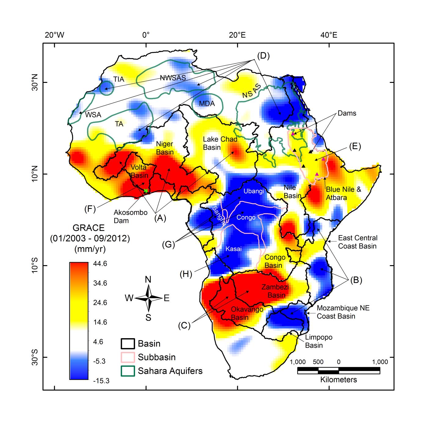
Trends in GRACE-derived TWS across Africa.
We are developing and applying an interdisciplinary system approach involving analysis of GRACE, remote sensing, and relevant data sets (e.g., stream flow) along with hydrologic modeling to accomplish the following: (1) develop quantitative macro-scale hydrologic distributed grid models (grid size: 0.5° x 0.5°) for the African continent that can account for vertical and lateral mass movement, (2) calibrate the model against temporal measurements from GRACE over selected suite of grid cells that have high signal/noise ratio, and (3) conduct simulations using the calibrated hydrologic model with forcing datasets from global climate models to predict the response of land and/or hydrologic units (e.g., regional vegetation [forest, crops], soil water storage, wetlands, lakes, streams, shallow groundwater, etc) to projected climatic changes in Africa. These activities build on, and take advantage of, our recent findings that indicate that the temporal mass variations from the GRACE solutions, acquired over northern and central Africa and as far as 10° south of the Equator, smoothed using a 250 km radius Gaussian, are largely controlled by elements of the hydrologic cycle (e.g., runoff, infiltration, ET, and recharge), and have not been obscured by noise as previously thought. The work will provide a replicable model that can be used on regional and continental scales world-wide.