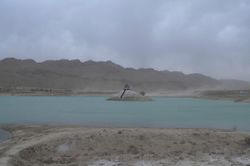
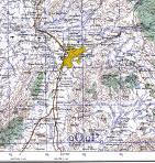
 We are applying an integrated interdisciplinary approach for groundwater exploration in the Quetta Valley in which inferences from remote sensing data are being integrated with observations extracted from other relevant data sources such as geochemistry, field geology, geophysics, and surface runoff and groundwater flow modeling for a better understanding of the hydrological setting, the groundwater potentialities, and for identifying potential locations for productive wells. A five-fold exercise is being conducted to assess the groundwater potentiality in the Quetta valley of Pakistan. Starting in 2007, a field campaign will be conducted to sample and analyze groundwater and surface water samples from the area of investigation area for geochemical, isotopic (e.g., O, and H stable isotope compositions),and geochronologic analysis (e.g., 14C and 36Cl). Second, a database will be generated to host all relevant data sets including published data in a GIS environment for a better understanding of the spatial relationships between these data sets. Co-registered digital mosaics will be generated from relevant data sets including remote sensing (e.g., Landsat TM, SIR-C, SRTM, TRMM), geochemical (solute concentrations, O and H stable isotope composition), geological (geologic maps), and hydrological (e.g., lithology, depth to water table) data sets. Third, a web-based GIS interface (ArcIMS) will be developed to provide a vehicle for data analysis, visualization, and dissemination. Using the developed
  web-based GIS and geophysical methods, locations for potential productive wells targeting different types of shallow (<200m) reservoirs will be identified. The validity of the methodology will be tested against existing wells in the Quetta valley. Fourthly, calibrated rainfall runoff models and groundwater flow models will be developed to simulate runoff, recharge, and to compute sustainable extraction. Fifthly, throughout the duration of theproject, the national researchers will receive locally and in the US training on various aspects of the adopted integrated applications and approaches. Specifically in the applications of GIS, remote sensing, geochemistry, surface runoff modeling, groundwater flow modeling, and geophysics in groundwater exploration.

Our approach is most suited for applications in the arid parts of the world for the following reasons: (1) we utilize global remote sensing data sets that are readily available for most of the world’s land surface, (2) we utilize cost-effective technologies that are not alternatives to drilling and geophysical approaches, but calls on these methodologies as a final step in the investigation, (3) the adopted web-based GIS technologies will provide efficient means for the distribution of data sets to the local geologists. Such an approach will ensure widespread and long lasting benefits for the project on the national and regional scales.
Collaborators:
Dr. Shuhab Danishwar Khan, University of Houston
Dr. Abdul Salam Khan, National Center of Excellence In Mineralogy, University of Balochistan, Quetta, Pakistan
Dr. Khalid Mahmood, National Center of Excellence In Mineralogy, University of Balochistan, Quetta, Pakistan
Mansoor-ul-Hada Abbasi, Iqra University, Quetta, Pakistan
Sponsor:
US Agency for International Development, in cooperation with the Higher Education Commission of Pakistan